
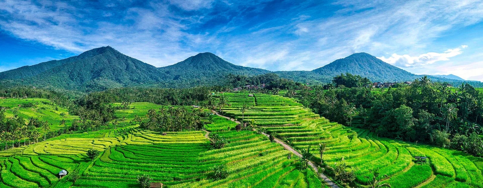

Bali cannot be reduced to a single beach image. Water also appears in lakes, sacred springs and irrigation systems shaping agricultural land. Seeing those connections helps link places that excursion maps often present as isolated photographs. These ten visits offer different ways to explore that relationship.
The selection spans the south, Gianyar and Tabanan, so it needs several days and realistic transport decisions. It does not attempt to cover the whole island or require two rice-terrace visits if you would rather give one more time. Choose complementary experiences and leave space for the everyday life encountered between them.
Before you pack
- Country
- Indonesia
- Areas
- Badung, Gianyar and Tabanan
- Suggested pace
- Four or more days for this selection
1. Tanah Lot: a temple facing the ocean
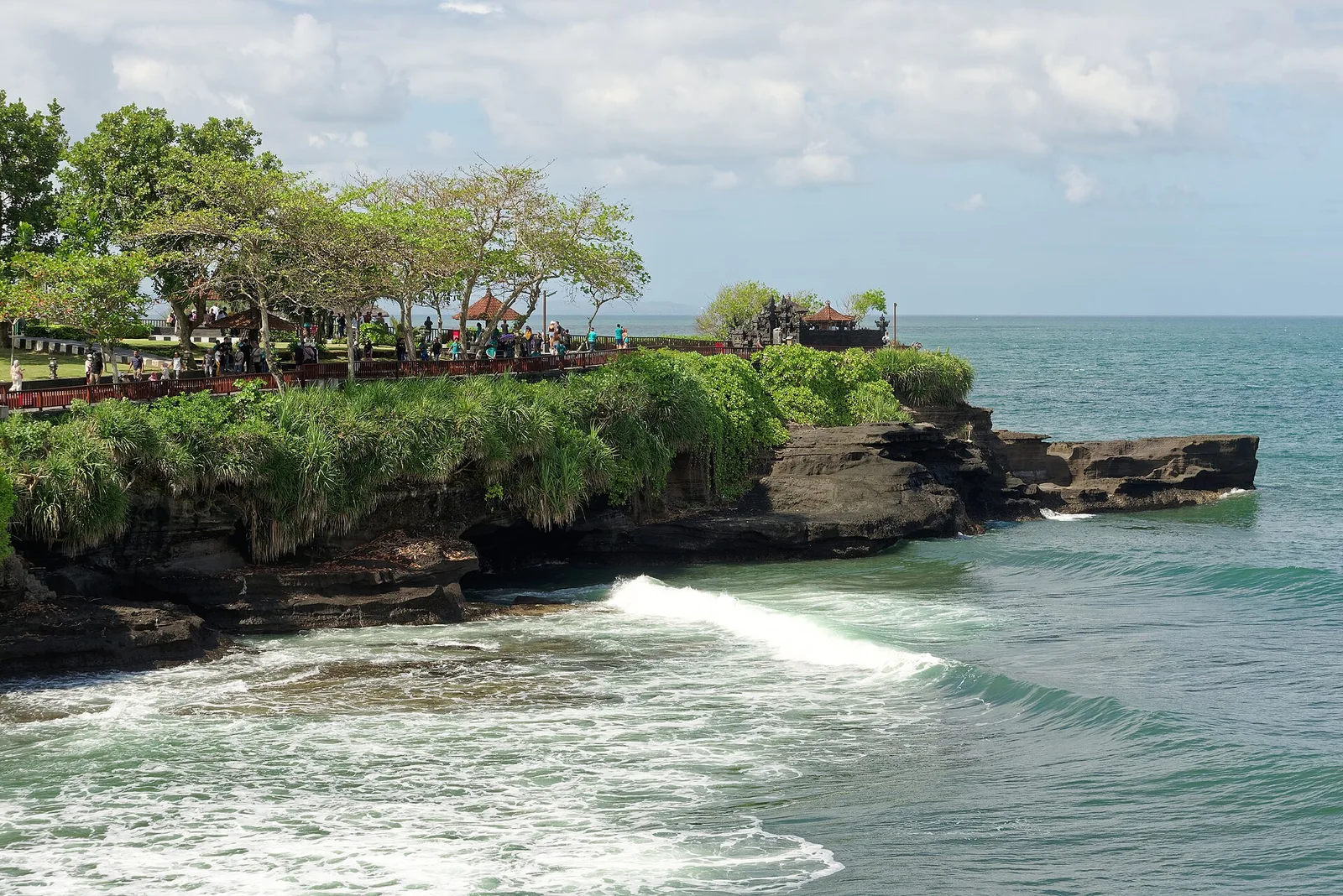
Tanah Lot in Beraban combines a temple on a rocky outcrop with the movement of the ocean. The visit works best as a coastal and religious landscape, rather than simply a building you must enter. Walk through authorised public areas and notice how the relationship between rock, water and horizon changes from different viewpoints.
The provincial tourism office highlights sunset, but you do not need to wait until then to appreciate the setting. Choose your timing around light, weather and the journey afterwards. Respect barriers and instructions about the sea: exposed rock in a photograph does not guarantee access during your visit. Do not assume you can enter worship spaces reserved for religious use.

2. Taman Ayun: Mengwi’s royal temple
Taman Ayun stands in Mengwi, in Badung regency. Its connection with the former local royal household and its inclusion in the subak cultural landscape offer two ways to understand it: ceremonial architecture and the relationship between community, water and territory. It makes a useful introduction to that context before visiting rice terraces.
Explore the areas open to visitors with attention to the layout, not only the most recognisable roofs. Viewing a sacred space from its perimeter can still be a complete experience; every doorway need not be crossed. You could combine it with an outing towards Tabanan, provided actual road conditions leave enough time to pause and eat rather than rushing through both stops.
3. Jatiluwih: walking through a farming landscape
Jatiluwih lies in Penebel, Tabanan, at the foot of Batukaru. Terraces follow the contours and reveal the rice fields as working land as well as scenery. UNESCO’s explanation of subak helps show how water is organised through cooperation and infrastructure: this is more than a sequence of green fields for photographs.
Choose an authorised route that fits your available time and stay on the paths. Field appearance depends on the farming cycle; an intensely green photograph does not represent every week of the year. Ask where you may walk and seek permission before photographing people at work up close. If irrigation interests you, a local explanation can add more than extending the walk without context.
4. Ulun Danu Beratan: architecture beside the lake
Ulun Danu Beratan stands beside Lake Beratan in Candikuning, in the Bedugul area. Its tiered shrines and mountainous background create a different picture from Tanah Lot: here water belongs to a highland lake landscape. The temple’s tradition is connected with Dewi Danu, the lake goddess.
Give time to the setting rather than only the viewpoint where the building appears to float. Water level, light and cloud change that impression. Pack an extra layer and rain protection according to the local forecast, which may differ from the coast. Treat the journey as a highland outing and leave time to return without adding too many distant stops to the same day.
5. Tirta Empul: understanding sacred water
Tirta Empul in Gianyar is associated with springs and purification practices. Water has religious meaning for worshippers; observing that relationship respectfully reveals a dimension of Bali beyond the appearance of its monuments. You do not need to take part in a ritual to appreciate what is happening around you.
If you wish to participate, ask the people responsible about the procedure, clothing and eligibility. Do not imitate a practice simply because someone else is doing it, or treat the space as a recreational pool. Keep your distance when photographing and seek permission. Local purification beliefs should not be understood as medical guarantees; architecture and cultural observation can form a complete visit on their own.
6. Gunung Kawi: shrines carved into rock
Gunung Kawi presents shrines carved into rock walls and small meditation spaces in a complex overlooking the Pakerisan River. The relationship between terrain and architecture distinguishes it from temples centred on freestanding buildings. Look at how the carved forms use the cliff itself as both background and support.
Access involves descending many steps: plan the return with as much care as the approach. If stairs do not suit your mobility, choose another visit rather than assuming the descent is short or easy. Carry water and wear footwear with good grip. Set a pace that lets you examine the stone details without reaching the end of the route having used all your energy.
7. Goa Gajah: the cave and its carvings
Goa Gajah is in Bedulu, in the Blahbatuh area of Gianyar. The decorated cave entrance receives much of the attention, but the religious purpose and interior elements, including a Ganesha figure, also matter. Its familiar name, Elephant Cave, should not be mistaken for an elephant-viewing activity.
Allow time to examine the reliefs before entering, if access is available. Respect the flow of visitors in narrow spaces and avoid touching carved surfaces. It can form part of a Gianyar outing with other places near Ubud, but choose combinations according to the actual route from your accommodation, not a list promising to cover the whole regency in a single morning.
8. Ceking: the terraces of Tegallalang
The Ceking terraces are in Tegallalang, Gianyar, on sloping land where rice fields and irrigation channels shape the scene. They offer a more concentrated view of a cultivated valley than an outing to Jatiluwih. If time is short, choosing one of the two areas lets you appreciate its context instead of repeating hurried photographs.
Before walking, check where access is allowed and which entrances or activities have separate conditions. Seeing a path from a terrace does not establish that it is public. Avoid stepping into crops or interrupting farm work for a photograph. Let the shape of the land guide your attention, remembering that cultivation stages change both colour and the amount of visible water.
9. Tegenungan: a waterfall in Gianyar
Tegenungan waterfall lies in the Sukawati area of Gianyar, outside Ubud. It introduces a riverside landscape after temples and rice fields. The appeal is the falling water and its setting; think of the visit as observing a natural place with changing conditions, not as a guaranteed swimming activity.
Check access conditions and the day’s restrictions before descending. Water flow and weather may change both the route and the areas where visitors can remain. Wear footwear suited to wet surfaces and respect closures. If approaching the water is not permitted, observe from an authorised viewpoint instead; an earlier photograph is no reason to cross a barrier or enter the water.
10. Pandawa: a southern beach between cliffs
Pandawa Beach is in Kutuh, south of Kuta, in Badung. The approach between high cliffs and statues associated with the Pandawa brothers of the Mahabharata is part of the experience before you reach the sand. It offers a way to devote an outing to the southern coast without turning the day into a succession of transfers.
Stop only where permitted if you want to examine the statues on the approach. At the beach, choose a place according to available shade and local instructions, not just the colour of the water. Confirm sea conditions before any activity and plan the return in good time. A relaxed afternoon on one stretch of coast can offer more than chasing several distant beaches.
Bases, journeys and when to visit
Choose a base around your main interests: the south, Gianyar and the highlands are not one neighbourhood. For this selection, group outings by area and keep the number of stops manageable. Agree on the route and return with an authorised transport service; check the day’s road estimates and avoid a plan that only works if every journey has no delays.
The best timing depends on your priorities and local forecasts. For terrace walks, path conditions and cultivation stages matter; for the coast, the sea; for Bedugul, highland weather. Carry sun and rain protection and review notices close to the trip. At temples, ask about clothing and access requirements, give ceremonies room to proceed and avoid stepping on offerings.
A route to get you started
- Gianyar outings: choose Goa Gajah and Tegenungan for one day, leaving a break between them. Save another for Tirta Empul and Gunung Kawi if the stepped walk suits your group. Ceking can be a visit in its own right or replace another stop, depending on your base and available time.
- Tabanan and Mengwi outings: Taman Ayun introduces the cultural landscape of water. Jatiluwih deserves an unhurried walk, while Ulun Danu Beratan requires a highland outing. Spread these over two days if the approach from your accommodation is long; Tanah Lot can form a separate coastal trip.
- Southern coast day: devote time to Pandawa and rest. Avoid making the afternoon depend on a tightly timed return from the highlands. With only a few days, choose two areas and save the rest of the island for a later journey.
Good to know
Should I visit both Jatiluwih and Ceking?
You can if agricultural landscapes are a particular interest, but it is not essential. Choose according to your base and time: a considered walk and an explanation of irrigation may offer more than two quick photo stops.
Can I take part in every temple ritual?
Do not assume so. Each space has rules, and participation requires guidance from those responsible. Observing from permitted areas is a worthwhile visit in itself; do not cross boundaries or interrupt ceremonies to get closer.
Does this route cover all of Bali?
No. It introduces several areas in the south and centre of the island. Other destinations and regions require their own planning; adding them all in a few days would reduce the useful time available at each place.
The value of this journey lies in connecting landscapes with the people who inhabit and care for them. A coastal temple, a spring and a rice field reveal different uses of water and land. Choose fewer transfers, give each place time to make sense and leave Bali room to become more than a collection of images.
Sources consulted
- Bali Provincial Tourism Office — tanahlot —
- Bali Provincial Tourism Office — tamanayun —
- Bali Provincial Tourism Office — jatiluwih —
- Bali Provincial Tourism Office — beratan —
- Bali Provincial Tourism Office — tirta —
- Bali Provincial Tourism Office — gunungkawi —
- Bali Provincial Tourism Office — goagajah —
- Bali Provincial Tourism Office — ceking —
- Bali Provincial Tourism Office — tegenungan —
- Bali Provincial Tourism Office — pandawa —
- UNESCO — Cultural Landscape of Bali —